Since 2015, Mission Val de Loire World Heritage, in partnership with the Urban Planning Agencies of the Tours Urban Area (ATU) and of the Region of Angers (AURA) has been providing local authorities of the UNESCO Loire Valley site with a programme of university workshops, "Habiter l’eau” in order to design and discuss the renewal of the Loire landscapes, with regard to new tourist, residential and agricultural uses. The 2017 and 2018 editions have seen the partnership increase to include the Établissement Public Loire and the Ministry for the Ecological and Inclusive Transition and have focused their work on the uses of the river area from the point of view of climate change.
The challenge
Relying on the knowledge of river landscapes and heritage sites, listed as UNESCO World Heritage, to steer the design of projects, to meet economic, societal and environmental expectations, in particular in terms of risk mitigation and adaptation to climate change.
Two points for discussion:
- The recreational Loire: contemporary modes of occupation are questioned from the following perspectives – stopovers (an invitation to take a break along a footpath, cycle path, on a boat, a break for refreshments and/or temporary accommodation), panoramic viewpoints (an invitation to understand the value of the place, even to contemplate, and the opportunity to revitalise thanks to the river’s proximity) and swimming (an invitation to enjoy water activities respecting regulations regarding safety and the preservation of the natural and cultural environment).
- The nourishing Loire: farming of the alluvial plains, in particular farming developed in the diked-up riverbed, is disappearing or transforming to create intensive farming areas, incompatible with the new climate situation. The point is to expand upon the discussion by questioning the future place of market gardening, eco-pasture, livestock farming, agroforestry and forestry as well as developments supporting the desirable cultivation of these floodable areas.
Presentation of findings
15 workshops were organised in all, involving 208 students supervised by 33 research professors from 6 higher education institutions:
- the National Graduate School of Architecture in Nantes;
- the "Agrocampus Ouest" Graduate School in Angers;
- the Fine Arts Graduate School – TALM (Tours – Angers Loire Maine);
- the Environment, Territory and Landscape (ETP) Master’s degree at the University of Tours;
- the Polytechnic School at the University of Tours (Polytech Tours);
- the National Graduate School of Architecture in Paris – La Villette;
- the DSA (Specialisation Diploma) at the School of Architecture of the town and regions of Marne-la-Vallée.
The workshops
Workshops along the riverbanks, in Maine-et-Loire, Indre-et-Loire and Loiret.
Maine-et-Loire, in liaison with the Angers Urban Planning Agency (AURA):
- Bouchemaine: showcasing the point where the River Maine and River Loire meet
- La Daguenière and La Ménitré: showcasing the banks of the Loire in relation to the town centres and agricultural plain;
- The Maine/Loire riverbanks in the Angers Loire Métropole: Proposals for using the abandoned river areas for other purposes;
- Chalonnes-sur-Loire island: a comparative look at the themes of the nourishing Loire and the recreational Loire.
Indre-et-Loire, in liaison with Tours Urban Planning Agency (ATU):
- Tours and La Riche: potential pathways and areas for swimming on the Loire banks
- Rochecorbon: reversible development of a camp on the banks of the Loire
- Montlouis-sur-Loire: the future of wine-making landscapes
- Vouvray: upgrading the area overlooking the Loire, where the River Cisse and River Loire meet
- Langeais: a site for reading the river heritage landscape to reinvent the link between the town and the Loire
Loiret, in liaison with the Établissement Public Loire:
- Taking the landscape into account in the showcasing of the banks of the Loiret, by supporting the Local Water Commission’s initiative.
The 2018 forum
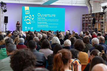
A forum is organised for 18 May 2018 to pool the results of the workshops. Lasting one day, it will bring together students, teachers, urban planning agencies, the Établissement Public Loire and representatives from partner local authorities.
Institutional representatives managing the public river network, the State, the Loire-Bretagne Water Agency, the Loire Anjou Touraine Regional Nature Park and the Regional Natural Spaces Conservation Centres will be consulted to define the approaches and projects helping to inform the implementation of the UNESCO site’s management plan and the commitment of riverside local authorities.
Presentation of results
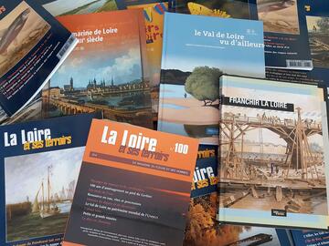
The conclusions of this research will be presented at the 12th Rendezvous of the Loire Valley as a final workshop alongside video clips, a project booklet and an exhibition which can be accessed in the Loire Valley resources portal and partner portals.
Two video clips have already been produced. They summarise the results of the workshops held in 2017.
To find out more
The "Habiter l’eau" (Living at the water's edge) Loire laboratory
In 2014-2015, seven university workshops helped to come up with ideas/projects on the banks of the Loire together with the local areas and their stakeholders. The aim of this initiative is to present new ways of looking at the fate of these spaces, set up opportunities for discussion and debate with elected local representatives and residents, develop programmes that factor in both the character of a site and its adaptation to contemporary uses, and envision possible futures.
- Resources
- Expositions itinérantes
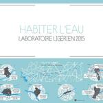
Habiter l’eau - Laboratoire ligérien 2015
Cette exposition restitue les travaux d'étudiants de quatre établissements d’enseignement supérieur, mobilisés par la Mission Val de Loire et les agences d’urbanisme des agglomérations d’Orléans, Tours et Angers, pour proposer de nouveaux regards sur le devenir des espaces ligériens, instaurer des temps d’échanges et de débats avec les élus et les habitants, construire
des projets associant le caractère du lieu et son adaptation aux usages contemporains, imaginer des futurs possibles.



![Nouvelles Renaissance(s] 2023](/var/storage/images/val-de-loire-refonte/dossier-de-parametrage/pied-de-page/nouvelles-renaissance-s-2023/517479-13-fre-FR/Nouvelles-Renaissance-s-2023_image_largeur220.png)

 Lettre d'information
 Facebook
 Flickr
 Podcloud
 Dailymotion
 Box
Box
 Slideshare
 Diigo
Diigo
