Mission Val de Loire wishes you all the best for 2019.
Design: MASAO productions / Sound: Histoire de sons
The hydrometric gauge, which measures the height of rivers, is a unique symbol of the Loire Valley forged by human activity down the centuries. It reflects both Man's vulnerability in the face of the river's whims, and the link that binds them. Through the developments that have been carried out in a bid to tame the river, activities have come about that still shape the cultural landscape listed as a Unesco World Heritage to this day!
Hydrometric gauges
At times discreet, in some cases forgotten and overgrown with vegetation in others, these gauges are nevertheless a feature all along the river.
A role
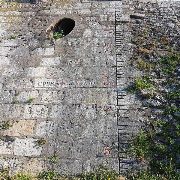
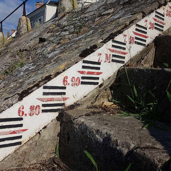
The height of water in the river can be measured thanks to these graded gauges installed in various locations. They look like metal rulers, either raised in cast iron or smooth in enamelled sheet metal. They are placed vertically or at a slant, depending on the surface to which they are attached: against a bridge abutment or pier, against a quay wall, riprap or steps running down.
Gauges must be installed in a precise, permanent fashion. As a rule, the zero is marked at the "conventional" low water level (average low water). With the widespread drop in water levels, this calibration – designed back when the infrastructure was built – is usually out of step with reality today.
Every now and then, markers of high water levels can be found in association with these gauges – setting in stone the memory of times when the river broke its banks, sadly with devastating consequences.
A style
The gauges are often coloured, white and blue, or white, red and black. Sometimes they are engraved and painted directly onto the stonework. To make it easier to measure the water level, engineers in the late 1860s recommended that the gauge background be white, that the lines and figures indicating the decimetres be blue, and that the points and figures indicating the metres be red.
Find out more
This explanatory text on hydrometric gauges comes from the "Loire Ports" exhibition.
- Resources
- Expositions itinérantes
Ports of the Loire
The toponymy of the Loire Valley World Heritage site still demonstrates to this day how the river has been used, especially in terms of boarding boats. "Port Boulet", "Port Charbonnier", "Port Poisson", "Port Saint-Maur" and "Port Thibaut" demonstrate how the relationship to water and access to the river are omnipresent.
You may be surprised by the vast number of ports dotted along the course of the river. This a territory punctuated with distinctive landmarks. The amount of infrastructure illustrates how much the Loire was used: pervasive, intense and essential.


![Nouvelles Renaissance(s] 2023](/var/storage/images/val-de-loire-refonte/dossier-de-parametrage/pied-de-page/nouvelles-renaissance-s-2023/517479-13-fre-FR/Nouvelles-Renaissance-s-2023_image_largeur220.png)


 Lettre d'information
 Facebook
 Flickr
 Podcloud
 Dailymotion
 Box
Box
 Slideshare
 Diigo
Diigo

