06/03/2025
[Fr] Décès de Philippe Auclerc
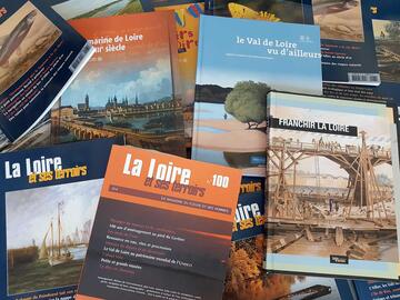
C'est avec tristesse que nous avons appris aujourd'hui le décès de Philippe Auclerc, co-fondateur de la maison d'édition "Loire et terroirs" et rédacteur...
Published on 10 June 2011 - Updated 23 March 2022
Cet article date d'il y a plus de 13 ans
180 players from Val de Loire, most of them local government officials, representatives of State departments (DREAL and DDT) and representatives of associations, took part in the two sessions of this UNESCO landscape workshop organised by Mission Val de Loire: a dual opportunity to gather information, share experience and enter into discussion. A landscape “specsheet” is to be published, recapitulating the conclusions reached during the course of the workshop.
The morning was devoted to reviewing fundamental issues and context: the characteristics of the Loire ports heritage, navigation of the river past and present, the orientations of the Management Plan with regard to the Loire ports, and the “Rivercraft and Ports” navigation plan. The afternoon was devoted to discussion of best practices in terms of port rehabilitation, and presentation of case studies and testimonies from local authorities.
Also: view resource documents
This series of UNESCO landscape workshops, implemented by Mission Val de Loire, accompanies the set-up of the Management Plan for the listed site, the objective being to organise information and exchange of best practices theme by theme.
For Sophie Saramito, Pays de la Loire Regional Councillor, the day – during which the Management Plan was very much on everybody’s mind – demonstrated the importance of the work carried out over the last 10 years, in particular the studies piloted by Mission Val de Loire, in ensuring that all local players joined together in imagining a future in which the Loire played a central role.
Michel Bacchi, Hydrobiologist, “Rive” Engineering Office, Associate Professor at the University of Tours
Since the 11th century, work has been regularly carried out on the Loire to prevent it from flooding and protect navigation. The heavy-handed techniques employed in the 19th century resulted in major modification of the riverbed’s geometry, the effects of which are still felt today. Added to this is the impact resulting from extraction of aggregates from the riverbed, which led to a fall in the low-water level. Together, these two phenomena have had major and as yet unresolved consequences (including weakening of bridges and disappearance of ecosystems).
Today, navigation on the Loire is partly professional (passenger boats for river exploration and professional fishermen) and partly recreational and tourist-centred (association of traditional rivercraft, kayaking, etc.).
Jean-Pierre Berton, President of the Boutavent Association, Professor Emeritus at the University of Tours
The continued operation of traditional rivercraft and development of new forms of river transport require adaptation or installation of equipment throughout the length of the Loire, to facilitate access to the water, develop the river’s ports, and set up technical amenities for maintenance. Finally, in order to enable continuous upstream-downstream navigation, removal of impassable “black spots” (either permanently so or at low water level) would be indispensable. It should be kept in mind that action taken to render the river navigable also aids biodiversity, as such work will make it easier for species (fish in particular) to make their way from one section of the river to another.
Philippe Métayer, DDT49
The river is no longer classed as a waterway and its navigation is therefore at users’ own risk. Because of this, the State does not mark out a navigation channel, nor does it see to the upkeep of facilities connected with navigation. Such actions could be taken over by local authorities on an agreement basis. For example, individual regulation of river traffic was set up on the section between Bec de Vienne and Bec de Maine, along which a navigation channel was marked out by the Maine-et-Loire General Council.
Reflections arising from the discussions:
Any work carried out on “black spots” must, however, take account of the other uses to which the Loire is put – as a source of water for supplying urban areas, for example.
Development of recreational navigation, kayaking in particular, is likely to disturb ecosystems if practitioners do not know the river well. It would seem important to provide such users of the river with appropriate information, and also to arrange (annual) posting of signs indicating sensitive sites (islands and banks where human presence is likely to harm fauna).
Philippe Cayla, Secondary school geography teacher – Honorary researcher at the University of Angers
The Loire ports – interfaces between local economic activity and the means of transport provided by the river itself – are of major importance in our history. We need to know about how the river was used in bygone days in order to fully understand the monumental ports that are our heritage. Basing his findings on in-depth research work, Philippe Cayla has come up with a typology of our ports, identifying their forms, inclines, situations and various functions: natural slipway, floating slipway, apron slipway, stepped quay, etc.
Emmanuel Van Hille, DREAL Centre
The Loire ports are characteristic features of the Val de Loire landscape, adding a mineral touch to the greenery that typifies the rivers’ banks outside urban areas.
The Management Plan has identified the threats overhanging this part of our heritage and defined the directions that shared management by the players concerned (the State and local authorities) should seek to take. It also indicates the State’s commitments, including the carrying out of studies on the impact that action taken on the public waterways domain has on landscapes and heritage, and the taking into account of architectural heritage sites such as the Loire ports.
Myriam Laidet, Mission Val de Loire
The Management Plan for the site may have defined orientations, but the UNESCO landscape workshops’ job is to bring together local players (local authorities, professionals and associations) to establish conditions for implementation of these orientations, basing their conclusions on diagnoses, expert evaluations and best practices.
The “Rivercraft and Ports of the Loire” orientation plan has real impact on regional and départemental policies bearing on assistance and accompaniment of local authorities and associations. The navigation charter evokes the rules of ethical behaviour and responsibility essential to conciliation of different uses to which the river is put. Mission Val de Loire’s annual monitoring of the situation gives clear proof of the vitality of activities connected with the Loire, and of their economic impact.
Bertrand Penneron, Heritage architect
The main cause of deterioration of slipways and quays is neglect – lack of maintenance and use, and forgetfulness of their patrimonial nature. Spalling of paving stones and undermining of bases (a result of lower water levels), accentuated by revegetation and parking of cars, results in the disappearance of “fillers”, materials making up the embankment, rapidly leading to subsidence and deformation of structures and the laying bare of their foundations, in particular during floods. Rapid small-scale intervention at the first signs of deterioration ensures that work on a larger scale with consequent higher costs can be avoided later on.
Conservation measures consist of making provisional repairs while awaiting more refined work to be carried out. For example, removal of spalled slabs from paving (and conserving them in a safe place) and then filling in the spaces with gravel on a geotextile, which keeps the embankment in place.
Restoration involves clearing and excavation work, followed by creation of a riprap 60 to 80 cm below low water level, of a colour equivalent to that of the existing stone facing and made up of ever finer materials as it rises, along with rubbling and paving. Rubble stonework is sometimes required to keep the structure standing. Finding the right paving slabs for such restoration work is no easy matter.
Once the structure is restored, it would seem good sense to disseminate enforceable recommendations for use, in order to restrict practices likely to bring about deterioration, and to raise awareness of the risks attached to port development. Taking account of new uses will lead to development that risks blurring the reading of this monumental heritage: a balance between the two must be sought.
Testimonies from local authorities
The day ended with presentation of 3 case studies:


![Nouvelles Renaissance(s] 2023](/var/storage/images/val-de-loire-refonte/dossier-de-parametrage/pied-de-page/nouvelles-renaissance-s-2023/517479-13-fre-FR/Nouvelles-Renaissance-s-2023_image_largeur220.png)