Plan for Territorial Urban Development Coherence (SCoT)
Published on 27 September 2016 - Updated 04 January 2021
The SCoT is a medium- to long-term planning document (15 to 20 years), at the scale of the municipalities on the territory. It seeks to ensure coherence in terms of urban planning, housing, economic growth, travel and the environment through an overall approach.
The SCoT is developed by local officials as part of an extensive consultation process involving institutional and private stakeholders. It is drafted following an environmental assessment.
Three sections make up a SCoT file:
- the presentation report comprising a territorial and environmental analysis;
- the spatial planning and sustainable development project (PADD) setting out the strategic objectives;
- the guidance and aims document (DOO) bringing together the provisions applying the principles of the SCoT PADD.
The guidelines and requirements outlined at the scale of a large territory (macroscopic scale) are then factored into the urban planning documents drawn up by the local authorities. The local urban development plans (PLUi and PLU), urban travel plans (PDU) and local housing programmes (PLH) must be consistent with the guidelines in the SCoT.
OUV and the plan for territorial urban development coherence
The State’s information document (PAC) forwarded to the intermunicipal joint association (SMI) in charge of drafting or revising the SCoT comes with a statement of key Loire Valley World Heritage issues specific to the municipalities concerned by the boundaries of the UNESCO Property, whether in the central or buffer zones.
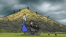
The statement recalls the key issues regarding the UNESCO listing, the guidelines of the UNESCO Property Management Plan and the terms of the expected procedure: performance of a precise and detailed landscape assessment, to be included in the SCoT presentation report by clearly factoring in the OUV components and current state of the landscape (whether natural or urban) by means of a map and photos. This landscape study must bear on both banks of the River Loire so as to address the reversibility of views and cross-cutting perspectives, thereby safeguarding the spirit of the site.
Analysis of the following major landscape aspects: control of urban sprawl, safeguarding of green continuities and undeveloped and wooded hillsides, maintenance and/or restoration of outlooks, respect for the traditional urban structure within the existing urban fabric and its extensions, and requalification of entrances to towns.
On the web:

![Nouvelles Renaissance(s] 2023](/var/storage/images/val-de-loire-refonte/dossier-de-parametrage/pied-de-page/nouvelles-renaissance-s-2023/517479-13-fre-FR/Nouvelles-Renaissance-s-2023_image_largeur220.png)