A new heritage and landscape focus point
The development of the "Loire-city centre" is giving a new focus point to the town, by extending it to the river and its two banks. This approach aims at restoring the heritage and landscape values inherent in areas and at grounding the project design in these very aspects.
Background
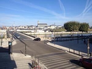
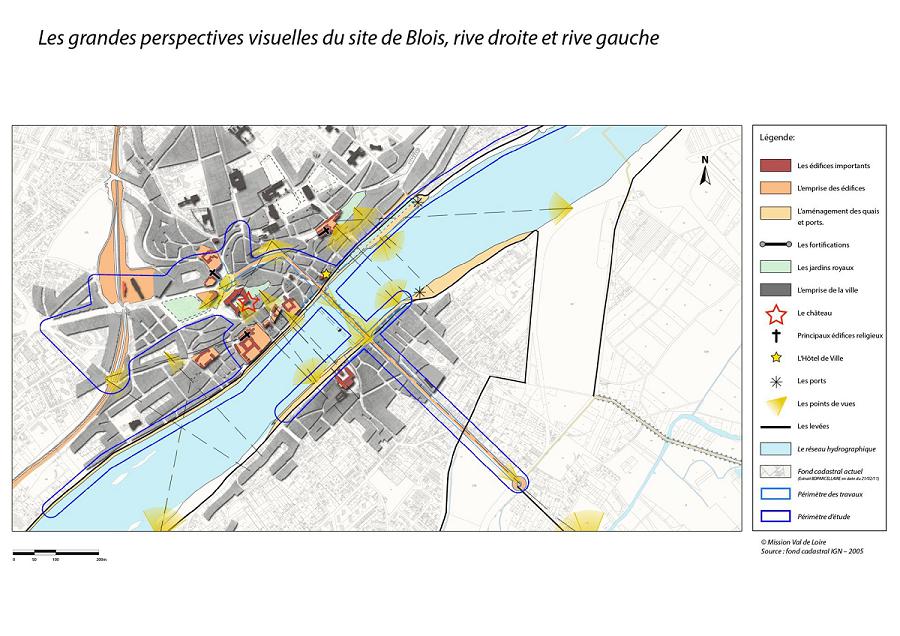
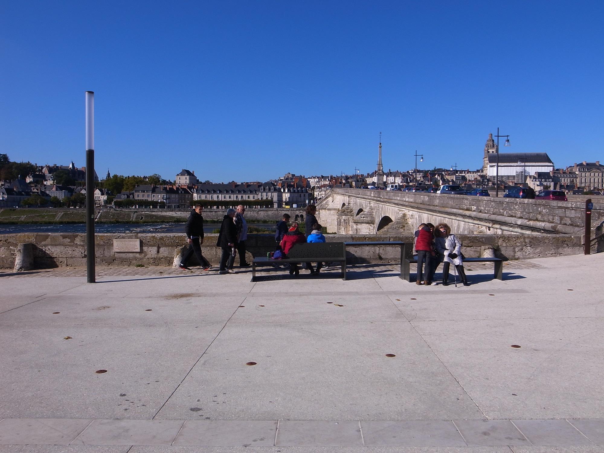
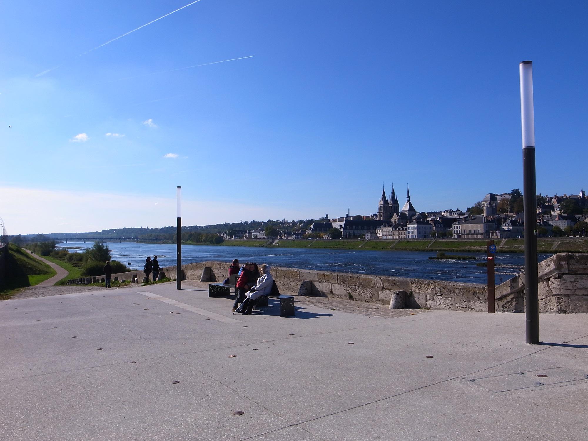
Blois' riverfront displays an exceptional urban arrangement shaped by major religious and civil buildings, ports and quays and one of the finest bridges over the Loire to have been built in the 18th century. But ties with the river have weakened as overly road-oriented contemporary developments have risen to the fore. This urban amphitheatre overlooking the Loire merits reconsideration in a bid to showcase it afresh.
Aims
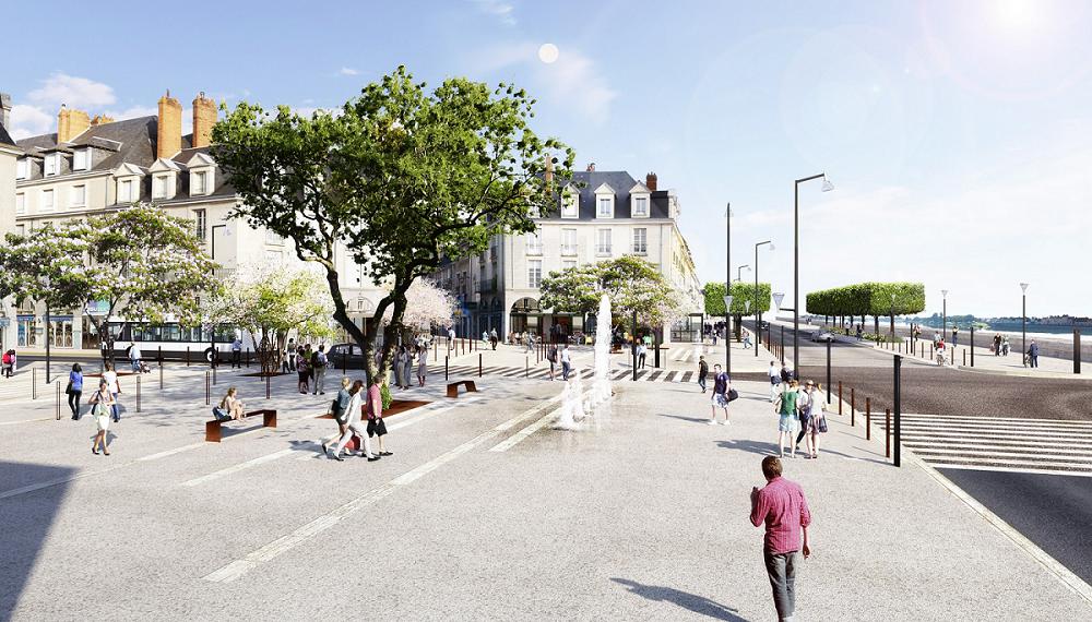
The aim is to improve locals' living environment, boost trade and attract new residents and visitors. A revitalised, modernised public space paves the way for environmentally-friendly travel trends and pedestrian-only lanes. This meaningful project would not be possible without the active participation of residents and local businesses alike.
Delivery
The project was launched in late 2012 with the recruitment of a group of engineering firms coordinated by SATIVA Paysage and involvement of landscape architects, urban planners, "lighting" designers and urban transport specialists.
This team conducted a landscape and heritage assessment, rounded off by consultation workshops with residents and local businesses. Mission Val de Loire also commissioned a historian to conduct a historical assessment. Her work was made available to the design team and included research into cartographic and iconographic archives.
- Bibliography and documents
The OUV components and recommendations for consideration in the project were defined collectively, following the initiative of the town and Mission Val de Loire, between the State, the engineering group, municipal departments and representatives of users' associations.
Outcome and outlook
The OUV components identified at project level threw light on the views from/over the monumental urban amphitheatre, the continuity of water and river management in the town's development and the major role of Square Augustin Thierry in the town's heritage arrangement.
Consideration of the OUV in the design enabled significant progress to be made in the redevelopment of the 18th century bridge: laying down of a second pavement and two cycle lanes, reconfiguration of the two bridgehead areas, thus increasing the space available for people to gather and for discovering the sites, and recognition of the square's identity as urban heritage and a 19th century masterpiece specific to the contemporary town.


![Nouvelles Renaissance(s] 2023](/var/storage/images/val-de-loire-refonte/dossier-de-parametrage/pied-de-page/nouvelles-renaissance-s-2023/517479-13-fre-FR/Nouvelles-Renaissance-s-2023_image_largeur220.png)