The study aims to incorporate, into an evaluation of the socio-economic value of landscapes, the well-being perception of the people who live there. The fieldwork for this study has been completed for the first site in the east of the Loiret département in the Centre-Val de Loire region, and will commence on the second site to the east of Angers in the Pays de la Loire region – both sites are part of the Loire Valley UNESCO site. The Mission Val de Loire Scientific and Professional Council came up with this study which began in spring 2016 and is carried out with a scientific consortium. It is being funded by the ERDF.
Observation and survey
The study began with an observation of the Loiret site and the identification of resource people for the interviews and the collection of town-planning data.
Data collection and analysis
At the same time, data collected on agriculture, companies, urban development and demography enabled maps to be produced to reflect the evolution of the municipalities' landscapes. By cross-referencing these maps with the examination of the aerial orthophoto and photos taken in the field, the changes in the landscapes since 1988 will be able to be assessed.
Interviews, trails and workshops
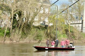
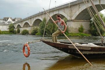
33 guided interviews lasting on average 1 hour or even 1.5 hours were carried out. They highlighted a good perception of well-being while discontent was more difficult to express. Well-being was more associated with the view of the River Loire, in particular via the Loire à Vélo cycle path, with unique sites in the area or with other factors such as employment, level of education or the presence of historical monuments like the Château de Sully.
They enabled well-being perception maps to be produced which may be compared with the identified changes in the landscapes and heritage, starting from the assumption that the landscape is a product of the economy and that its changes are the result of changes in economic activities.
On 4 November 2016, a trail brought together the people interviewed and key stakeholders in the local area concerned for a collective interpretation of the landscapes. It was an occasion which enabled the perceptions held by these various stakeholders of landscapes and heritage to be shared and addressed on the sites themselves.
Following on from the trail, a summary was drawn up and shared during a workshop on 26 January 2017, organised to collect participants' opinions on the approaches of economic activities which change the landscapes and heritage and which provide more or less well-being or discontent and to start to identify criteria enabling an analysis of these perceptions. During this workshop, the video recorded during the trail was presented to gauge the participants’ reactions.
Continuation of the project
Analysis and survey work began on the Maine-et-Loire site in March 2017.
On the basis of field experiences, work on the indicators will be launched by research laboratories, the results of which will be reported to the elected representatives for the municipalities concerned and will be showcased through information and exchange measures which Mission Val-de-Loire is setting up with local stakeholders.
Partners
The scientific consortium which is helping Mission Val de Loire is made up of:
- Citères laboratory at the University of Tours
- LADYSS laboratory at the CNRS and Universities of Paris 1, 7, 8 and 10
- CEMOTEV, laboratory of the University of Saint-Quentin-en-Yvelines
- Association Passeurs, which is responsible for interviews and the trails and workshops in collaboration with the researchers and members of Mission Val-de-Loire who have been brought on board
Study sites
The municipalities concerned by the study:
- Loiret site (Centre-Val de Loire Region): Châteauneuf-sur-Loire, Germigny-des-Prés, Guilly, Ouvrouer-les-Champs, Saint-Benoît-sur-Loire, Saint-Père-sur-Loire, Sigloy and Sully-sur-Loire.
- Maine-et-Loire site: Trélazé, La Bohalle, Brain-sur-l'Authion, Corné, La Daguenière and Saint-Mathurin-sur-Loire, St-Rémy-la-Varenne, Blaison-Gohier, St-Jean-des-Mauvrets and St-Sulpice-sur-Loire.


![Nouvelles Renaissance(s] 2023](/var/storage/images/val-de-loire-refonte/dossier-de-parametrage/pied-de-page/nouvelles-renaissance-s-2023/517479-13-fre-FR/Nouvelles-Renaissance-s-2023_image_largeur220.png)